
Sophisticated Censor by Google - Alphabet

On a recent Monday in the West Bank, human rights attorney Diana Buttu found herself stuck in traffic for nine hours to drive a distance less than 10 miles. Israeli authorities had set up a temporary checkpoint on her route, creating a massive backup of cars on a busy highway in the disputed Palestinian territory. In much of the world, drivers can avoid—or at least, anticipate—these kinds of roadblocks by checking apps such as Google Maps. But for years, that’s been easier said than done in the West Bank, home to several million Palestinians.
Residents in the West Bank have long complained that missing and outdated data on Google Maps, including accurate information about road restrictions and street regulations, make the app unreliable and sometimes difficult to use. The start of the war in Gaza in October of last year, however, has made problems with the app even worse for drivers such as Buttu, a former legal advisor to Palestinian government officials. “I’ve been so irate with all of this,” she says. “You spend so much brainpower trying to maneuver.”
WIRED spoke with Buttu and four other people who have driven recently in the West Bank who say the world’s most popular navigation app sometimes leads users into traffic jams, walls, and onto restricted roads where they may have potentially dangerous encounters with Israeli authorities.
[Lawyer Diana Buttu]
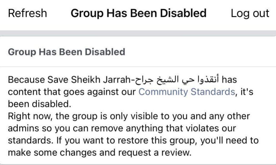
These problems have prompted Palestinians to crowdsource information about congestion and other road conditions themselves on social media.

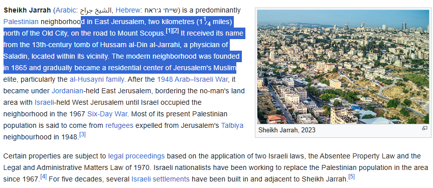
[Sheikh Jarrah, West Bank, Palestine]
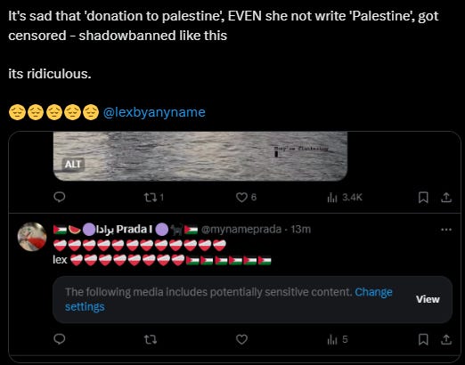
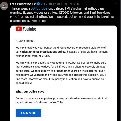
Social media censorship is a global phenomenon, but the war on pro-Palestinian views on social media represents a different kind of censorship, with consequences that can only be described as dire.
Long before the current devastating war on Gaza and the escalation of Israeli violence and repression in the Occupied West Bank, Palestinian and pro-Palestinian voices have been censored.
Some date the censorship to an agreement in 2016 that, according to the Israeli government, sought to “force social networks to remove content that Israel considers to be incitement.”
This was translated, almost immediately, to the shutting down of thousands of accounts and the barring of many social media influencers, with the hope of slowing down the vastly growing pro-Palestinian tendencies in all platforms in internet.
The war on Gaza, however, has escalated the censorship. In a report submitted to the United Nations Special Rapporteur on Freedom of Opinion and Expression, Human Rights Watch noted that the documented restrictions on freedom of speech “undermine the fundamental human rights to freedom of expression and assembly.”
The censorship became so sophisticated and increasingly involved a direct Israeli role. To ensure that ‘offenders’ to Israeli sensibilities were eliminated in large numbers, Meta began censoring specific words, thus deeming entire contents offensive, racist and anti-Semitic.
But Meta was not the only social media network involved in this practice. On 17 November, 2023, the X platform (previously known as Twitter) declared that users who write terms like “decolonisation”, “from the river to the sea”, or similar expressions would be suspended.
One year later, the social media platform Twitch followed suit by revising its ‘Hateful Content Policy’ to include “Zionist” as a potential slur.

Not only do these decisions, and many others, directly impair the freedom of speech and press, but they also confuse rational conversations with anti-Jewish sentiments.
The word ‘genocide’, for example, is not a swear word, but a common term, embraced by numerous countries around the world, accusing Israel of carrying out acts of genocide, meaning the “systematic destruction of a group of people because of their ethnicity, nationality, religion, or race”.
Under pressure from many countries, and after presenting a powerful case at The Hague, South Africa managed to compel the International Court of Justice to investigate Israel’s acts of genocide in the Gaza Strip in violation of the 1948 Genocide Convention.
Back to Google.
Some of the issues raised by users stem from circumstances outside of Google's control: Checkpoints have become more common and variable in wartime, and Israel has interfered with GPS readings in the area. But the users say they believe the tech giant could be doing more to make Google Maps safer and more dependable for Palestinians.
Inside Google, dozens of employees have been urging company leaders over the past year to make improvements to Google Maps that would benefit Palestinians, according to three current and former staffers involved in the advocacy or on the maps product team, who asked to remain anonymous because they were not authorized to speak publicly.
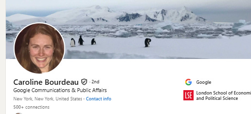
One current Google employee alleges, based on internal data they’ve seen, users in the West Bank have largely abandoned Google Maps for navigation. Google spokesperson Caroline Bourdeau declined to comment on the assertion. She says traffic jams caused by checkpoints are reflected in Google’s routing and estimated time of arrival calculations.
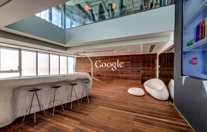
Very stark contrast with Google - Israel office.
Google has recently moved into an incredible new office space Tel Aviv, Israel. Designed by Camenzind Evolution, in collaboration with Setter Architects and Studio Yaron Tal, the impressive 8,000 sqm campus occupies 8 floors in Electra Tower.
With incredible views of the city, the space is set primed for not only giving employees the right tools for work, but also those for inspiration and creativity. Colorfully-themed rooms and local styling are something I’ve come to love about Camenzind Evolution’s Google office designs.
“It is a new milestone for Google in the development of innovative work environments: nearly 50% of all areas have been allocated to create communication landscapes, giving countless opportunities to employees to collaborate and communicate with other Googler’s in a diverse environment that will serve all different requirements and needs.
There is clear separation between the employees traditional desk based work environment and those communication areas, granting privacy and focus when required for desk based individual working and spaces for collaboration and sharing ideas.
Each floor was designed with a different aspect of the local identity in mind, illustrating the diversity of Israel as a country and nation. Each of the themes were selected by a local group of Googlers, who also assisted in the interpretation of those chosen ideas.
Being in Israel, for lunch the Googlers can choose from three amazing restaurants, for non-kosher, kosher dairy and kosher meat, each of the restaurants designed to it’s own style and theme.
Back again about censored by Google to Palestinian.
“Any claims of Google Maps showing bias in this region are false. We’ve updated thousands of roads, street names, place names and postal codes in the West Bank and Gaza—and are constantly working to get accurate data to help us map this highly complex area,” Bourdeau said in a statement.
Bourdeau told WIRED that Google was proactively reaching out to organizations and data suppliers in the region to update road, street name, and place information in the West Bank.
She describes the West Bank and surrounding areas as complex to map due to constantly changing conditions on the ground and available data being inconsistent and ill-defined. Google Maps stays neutral on geopolitical issues, she says.
Last month, Google Maps launched an update to help users easily look up West Bank addresses. Bourdeau says that overall, Google Maps has added about 5,000 miles of roads in the West Bank and Gaza since 2021. Nour Nassar, a director general in the telecommunication and digital economy ministry of the Palestinian Authority, which governs parts of the West Bank, tells WIRED she appreciates Google’s efforts.
Israel’s assault on Gaza has shined a spotlight on what some Palestinians perceive as a digital apartheid. Small groups of workers at several tech companies have protested how common services such as YouTube and Instagram are denied to Palestinians or operate less effectively for them. Google Maps, in particular, has been a source of simmering frustration for years.
In 2018, 7amleh, a Palestinian digital rights organization, published a report on mapping tools that accused Google of allegedly making design choices in its app that disadvantaged Palestinians and helped legitimize the Israeli government’s views of the contested territory.
“Google Maps, as the largest global mapping and route planning service, has the power to influence global public opinion and therefore bears the responsibility to abide by international human rights standards and to offer a service that reflects the Palestinian reality,” the report said.
Because online maps have become a primary way that billions of people understand the world around them, how tech companies like Google depict and label politically sensitive areas and territories regularly generates public backlash and philosophical debate. Some countries, including the US, India, and China, have imposed specific requirements on mapping providers over the years. But the issues in the West Bank center on a specific feature—navigation—that historically hasn’t drawn as much attention but, now as much as ever, poses real safety fears for users.
Buttu, who regularly travels to the city of Ramallah in the West Bank from her home in Haifa, Israel for work and to visit friends, says Google Maps has led her astray many times in recent years. “I’ve been told to drive right into a wall that’s been up since 2003,” she says.
Others have encountered the same wall near the Qalandia checkpoint separating Jerusalem from the West Bank, and almost driving into it has become something of a rite of passage. “I was once trying to get to an office that was in a neighborhood in East Jerusalem, and Google Maps absolutely failed me,” says Leila, who works for a US company remotely from Ramallah and asked to use only her first name for privacy reasons. “It wanted me to go on a road that was completely cut off by the wall.”
Google’s Bourdeau tells WIRED that the company is investigating the route and will make an update if it can verify the situation against reliable data.
Even before the war, Google Maps users in the West Bank say they were accustomed to receiving potentially unsafe directions. One persistent issue they point to is the fact that Google doesn’t distinguish between unrestricted roads and ones that are only permitted to be used by Israelis, such as those leading to and from Israeli settlements where Palestinians aren’t supposed to go. On the route from Haifa to Ramallah, Google Maps once directed Buttu to a closed gate where she says Israeli soldiers approached her car with their guns pointing toward her. “I had to explain I made a mistake,” she says. Google “optimizes for going on settler roads, which for me as a Palestinian, can be very dangerous.”
Bourdeau says Google does not distinguish between Palestinian and Israeli routes, as that would require knowing personal information about users, such as their citizenship.
When Google Maps leads her into settlements, Buttu says she speaks in English in the hopes of passing as a lost foreigner. Other Palestinian users tell WIRED that when they unexpectedly end up in risky areas, they try to turn around or backtrack as quickly as possible.
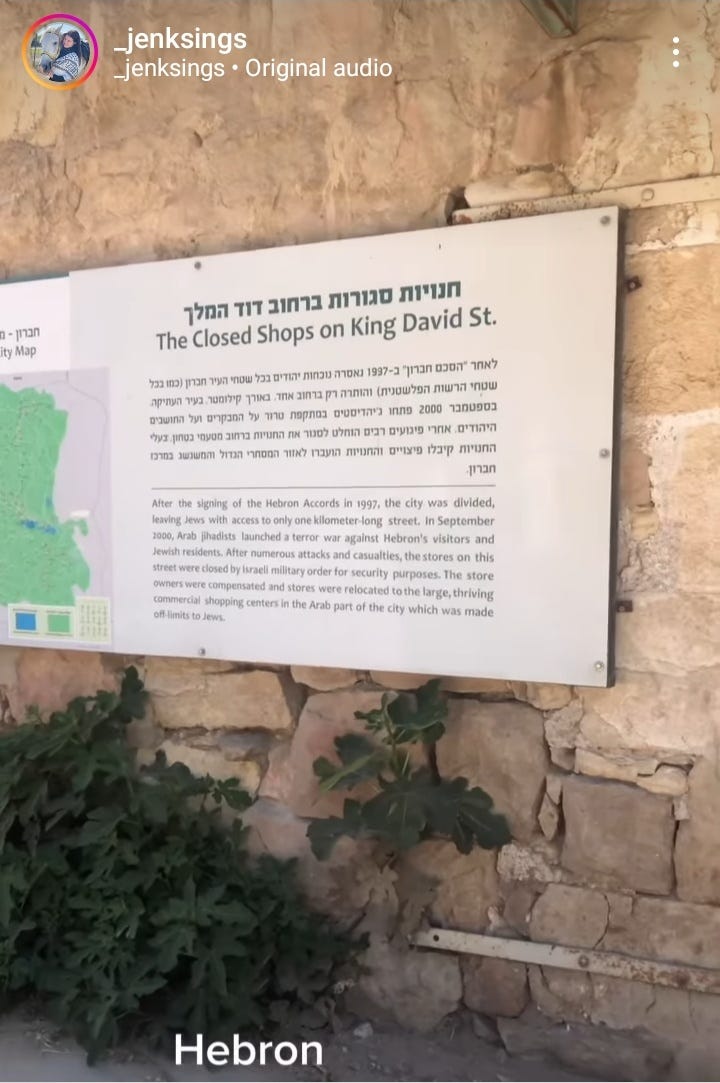
In other instances, Google Maps refuses to provide directions altogether, like when navigating between cities in the West Bank, including Hebron and Ramallah. Instead, the app tells them it “could not calculate driving directions” (WIRED was able to replicate the same result). One of the current Google employees says that’s because Google hasn’t invested in enabling directions between the West Bank’s three administrative areas, two of which are officially more controlled by Israeli authorities. Bourdeau, the Google spokesperson, says the company is working to address the issue.
Despite its drawbacks, users tell WIRED they still previously found Google Maps to be helpful in the region, especially when they traveled to unfamiliar places. Since the war began, though, they feel the app has become unbearable. Soon after the fighting started, Google shut off the ability to see an overview of live traffic in the region to protect “the safety of local communities.” Users now have to input a specific location to see traffic conditions along their route, adding a potentially additional step for some of them.
Two current Google employees also say that, due to shifting conditions on the ground during the war and an uptick in spam that tends to follow conflicts, Google hasn’t acted on many of the suggested edits submitted by employees and West Bank drivers, which alert the tech giant to problems like missing streets or places. That has caused road data on the app to become outdated over the past year. Bourdeau says Google applies updates when suggestions can be verified through reliable sources.
User contributions are important because Palestinian officials regularly adjust street regulations to keep traffic flowing on the windy and narrow roads that run through dense urban neighborhoods in the West Bank. “They will turn a two-way street into a one way or vice versa,” Buttu says, referring specifically to officials in Ramallah. “Almost every time I go, the road has changed.”
Jalal Abukhater, an advocacy manager for 7amleh who regularly visits cities in the West Bank, says he can spot drivers he assumes are using Google Maps because they are the ones heading the wrong way on a one-way street. “It’s just awkward,” he says.
Another issue is that Google Maps, like other navigation services, has struggled to identify users’ current locations at times this year because Israeli forces are interfering with GPS signals in the region to stymie Hamas fighters. “Once or twice before the war, it wouldn’t recognize where I was,” Leila says. Now, half the time Google Maps locates her in Beirut, Lebanon or Amman, Jordan instead of the West Bank, she says. Bourdeau says Google can’t speculate on the impact of the signal jamming because it doesn’t know when or where it occurs. A spokesperson for Israel’s military declined to comment.
Leila and the other users say alternative navigation apps aren’t necessarily any better. Some tell WIRED that Apple Maps is helpful in several West Bank cities, but it’s exclusive to iPhones, which are relatively rare in the territory. Google-owned Waze is another option, but users who spoke with WIRED say they have generally shied away from the app because it was founded in Israel. Bourdeau says the Waze team is spread across the world.
Many Palestinians have turned to Telegram channels, WhatsApp chats, Facebook groups, and an independent app called Azmeh—meaning traffic jam in Arabic—where they collectively share updates about traffic problems and new checkpoint locations. That information can then be used to manually plot routes. But the unpredictable nature of traveling in the West Bank means that people still need to incorporate up to three hours of buffer time in their schedules, Abukhater says.
These workarounds still fail. In September, Leila had to spend 30 minutes on the phone with someone who knew the area well to help find a friend’s house in an unfamiliar area of Jericho in the West Bank. A Palestinian tech worker living in Israel, who spoke on the condition of anonymity out of concern for their employment, says that last month a one-hour trip ended up taking five hours because a checkpoint had closed earlier than expected and Google Maps had given no indication that was the case.
Buttu, the Palestinian attorney, is dreaming of the day Google Maps develops features that feel inclusive of her community. About a month ago, she says she used the app while driving in the West Bank to locate the nearest gas station in the hopes of finding a bathroom. Buttu says the gas station denied her companion access to the facilities, allegedly because she was Palestinian.
Google Maps lets businesses label themselves as LGBTQ-friendly or women-owned. To Buttu, a similar label on the app for establishments in the West Bank to highlight themselves as Palestinian-friendly would be not only a welcomed small gesture from the tech giant, but also perhaps a vital improvement to what is already one of the most difficult places to navigate in the world.